System
Light
Dark
News
RSS, last 100
Podcast feed of the last two years
SD quality
Podcast audio feed of the last year
Podcast archive feed, everything older than two years
SD quality
News
RSS, last 100
Podcast feed of the last two years
SD quality
Podcast audio feed of the last year
Podcast archive feed, everything older than two years
SD quality
Search for "M" returned 12119 results
previous page
Sort by
Newest first
Oldest first
Relevance
next page
27 min
All the world’s GLAM institutions – and how we tried to find them
27 min
2019-10-26
39
Alicia Fagerving
WikidataCon 2019
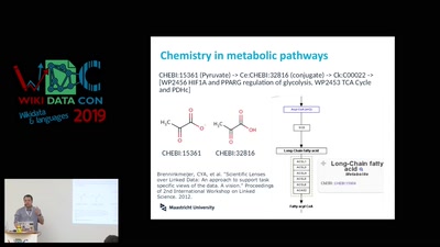
23 min
Cheminformatics to improve Wikidata on chemical compounds
23 min
2019-10-26
59
Egon Willighagen
WikidataCon 2019
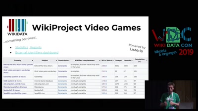
25 min
Sum of All video games − 2019 edition
25 min
2019-10-26
124
Jean-Frédéric Berthelot
,
Tracy Hoffmann
and
Envel Le Hir
WikidataCon 2019
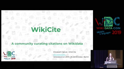
25 min
Wikicite panel
25 min
2019-10-26
95
Elizabeth Seiver
and
Simon Cobb
WikidataCon 2019
27 min
Teaching SPARQL as a Foreign Language
27 min
2019-10-26
249
Martin Poulter
WikidataCon 2019
25 min
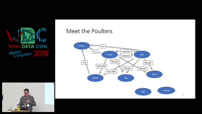
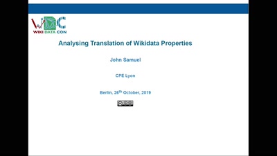
Analysing Translation of Wikidata Properties
25 min
2019-10-26
62
John Samuel
WikidataCon 2019
56 min
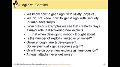
Internet of Things (IoT) Privacy & Security
56 min
2019-10-26
234
Ralf Schlatterbeck
PrivacyWeek 2019
49 min
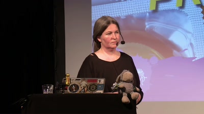
Digitale Gewalt gegen Frauen
49 min
2019-10-26
536
Anne Roth
PrivacyWeek 2019
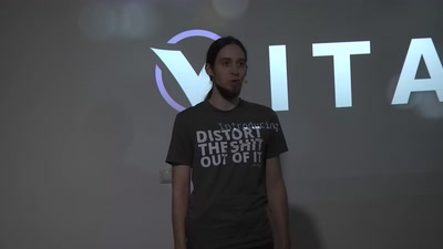
72 min
Vital
Introducing a new revolutionary wavetable synthesizer
Instruments
72 min
2019-10-26
236
Tobiasz “unfa” Karoń
Sonoj 2019
30 min
Surviving marriage using Wikidata
30 min
2019-10-26
55
Nicolás Giorgetti
and
Ivana Molena
WikidataCon 2019
30 min
Wikidata knowledge base completion using multilingual Wikipedia fact extraction
30 min
2019-10-26
140
Anders Sandholm
and
Michael Ringgaard
WikidataCon 2019
42 min
Warum meine Daten töten können obwohl ich nichts zu verbergen habe
42 min
2019-10-26
631
Katharina Larisch
PrivacyWeek 2019
25 min
Wikidata Statistics: What, Where, and How?
25 min
2019-10-26
144
Goran S. Milovanović
WikidataCon 2019
25 min
Barriers to Using Wikidata as a Knowledge Base
25 min
2019-10-26
126
Peter F. Patel-Schneider
WikidataCon 2019
58 min
Infoboxes panel
58 min
2019-10-26
51
Andrew Lih
,
Amador Alvarez
,
Mike Peel
,
Tpt
and
Harmonia Amanda
WikidataCon 2019
44 min
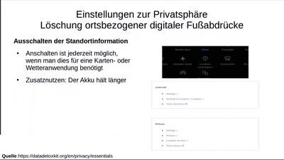
Quickwins für mehr Privatspähre und Sicherheit am Smartphone
44 min
2019-10-26
501
Katharina Larisch
and
Volker Wittpahl
PrivacyWeek 2019
49 min
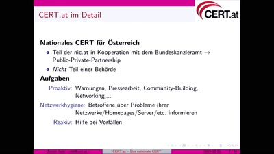
CERT.at - das nationale Computer Emergency Response Team
49 min
2019-10-26
148
Dimitri Robl
PrivacyWeek 2019
52 min
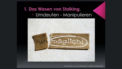
Stalking - die unterschätzte Gefahr
52 min
2019-10-26
167
Sandra Cegla
PrivacyWeek 2019
28 min
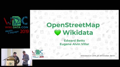
OpenStreetMap and Wikidata
28 min
2019-10-26
512
Edward Betts
and
Eugene Alvin Villar
WikidataCon 2019
24 min
Structuring GLAM-Wiki initiatives with Wikidata
24 min
2019-10-26
51
João Alexandre Peschanski
WikidataCon 2019
25 min
Open data panel
25 min
2019-10-26
48
Alice Wiegand
and
Knut Hühne
WikidataCon 2019
65 min
A song in Qtractor from scratch
Tracker
65 min
2019-10-26
241
Rui Nuno Capela
Sonoj 2019
55 min
Education panel
55 min
2019-10-26
33
Shani Evenstein
,
João Alexandre Peschanski
,
Ewan McAndrew
,
Akbar Ali
and
Debora Weber-Wulff
WikidataCon 2019
54 min
Data import process overview
54 min
2019-10-26
101
Navino Evans
,
John Cummings
,
Sean McBirnie
and
Ana Brandusescu
WikidataCon 2019
52 min
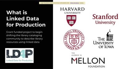
Libraries panel
52 min
2019-10-26
134
Hilary Thorsen et al.
WikidataCon 2019
previous page
next page